
Huntington Neighbors by Block
The immediate block is best described through land and community records. Start with the physical parcel at a known Huntington address, identify the lots that share a boundary, and label every result by its source. The parcel map establishes spatial adjacency. Assessment data gives an owner and mailing contact. Deeds can explain easements or past transfers. Permits document work at a service address. The city's association list offers a public route into neighborhood life, but it does not name all residents.
| Source | What It Shows About a Block | Access |
|---|---|---|
| Cabell Assessor GIS | Parcel outlines and nearby land context | Free online viewer |
| WV Assessment Search | Owner, mailing, physical, E-911 and parcel labels | Free online search |
| Cabell Clerk deeds | Legal description, parties, easements and prior instruments | Portal, counter, phone or copy request |
| Huntington permit portal | Permit type, number and activity by service address | Online portal or city office |
| Neighborhood organizations | Public contacts, meeting places and community context | City list and direct contact |
An owner is not necessarily an occupant. The mailing address may differ from the physical or E-911 address, and a company or trust can hold title. Likewise, a permit applicant may be a contractor, while an association contact speaks for a group without proving that every nearby household is a member. This block lookup supports careful property and civic research, not a claim about everyone who lives nearby.
Verify Huntington Neighbor Addresses
The state assessment detail card demonstrates why each address label matters. Its sample record separates an owner's mailing address, the parcel's physical address, and an E-911 address. Those fields can differ for sound administrative reasons. Copy each one exactly and do not replace one with another. A mailing city is not proof of municipal limits, and an owner's contact point is not proof of who is home.
The property record also supplies the parcel ID, tax year, deed book and page, legal description, class or use, valuation fields, and a map link. Those facts help distinguish adjoining lots with similar street numbers. If an address sits near Huntington's Cabell and Wayne relationship, verify the county and city layer before asking the wrong custodian for a record.
Map Huntington Neighbor Parcels
The official boundary comparison service exposes Cabell parcel, zoning, Census in/out, and HuntingtonCityBoundary2026 layers. Use them to establish where a parcel lies and which lots touch it. The 2026 label describes the available layer, but its presence alone does not prove the legal effective date of a boundary change. Check metadata and city records before stating that a line moved.
Start at one verified physical address, select its parcel, then inspect each polygon sharing a boundary. Record the parcel ID and street number for every lot. Corner parcels and rear lot lines can create adjacency that is not obvious from the street. Compare the map with the legal description and assessment detail before treating two properties as immediate neighbors.
The Huntington boundary service makes the layer names visible.
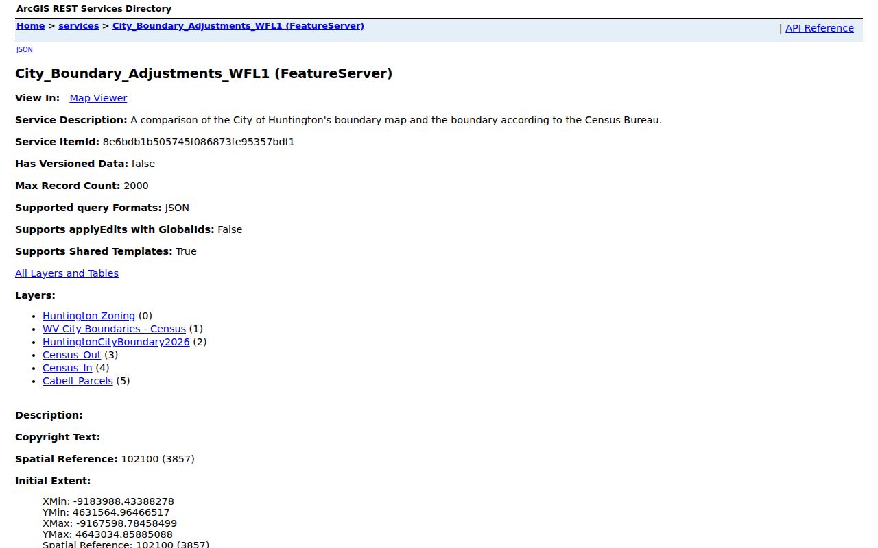
This inventory supplies geographic context, while assessment and deed records supply the role attached to each parcel.
Trace Huntington Neighbor Parcels
A short process keeps a neighbor search tied to the immediate area instead of drifting along the full street. Preserve the physical address first, then walk outward one parcel at a time. The result is a map of recorded property relationships, not a list of occupants.
- Normalize the house number, directional, street type, unit, and ZIP, while retaining the original spelling.
- Locate the physical address in the Cabell Assessor GIS and select the matching parcel.
- Inspect each touching parcel and save its parcel ID, physical address, and owner label separately.
- Compare assessment details, deed book and page, and any permit tied to the service address.
- Use the association list only for public meeting and contact context.
This flow is intentionally narrow. For every parcel along a road and the longer deed chain, use the Huntington street directory. For one block, stop after the surrounding parcels are documented and each public role is labeled.
Huntington Neighbor Property Records
The Cabell County Clerk's record room adds the legal link behind nearby parcels. Search a deed by grantor or grantee, date, document type, instrument number, or book and page. A grantor transfers an interest; a grantee receives it. The legal description can explain shared drives, easements, rights-of-way, and lot boundaries that matter on a block. The portal's online starting year was not published, so the Clerk's counter and phone at 304-526-8625 remain important fallbacks.
The Huntington permit portal supports service-address, permit-type, and permit-number work. It documents an application and municipal review, not occupancy. Processing and approval vary, and a contractor's portal role is not a resident relationship. When the portal is incomplete, contact the city permit or Planning and Zoning office through the city department directory.
- Parcel
- A mapped unit of land identified for assessment and record purposes.
- Legal description
- The deed language that identifies the land, often by lot, boundary, or prior survey.
- Easement
- A recorded right to use part of another parcel for a stated purpose.
- Service address
- The location where permitted work is proposed or recorded.
Meet Huntington Neighbors Locally
Huntington's Neighborhood Institute page lists public contacts and meeting patterns for local groups. Named organizations include Arlington Park, Chancellor Hills, Crossroads, Enslow Park, Fairfield West, Gallaher Village, Highlawn, Old Central City, Southside, West Huntington, and Westmoreland. The Southside Preservation & Enhancement Alliance appears as a corporate member.
Neighborhood Institute
Use the city list to find current public contacts and meeting details.
Cabell Assessor
Use parcel and assessment tools for land records, not association membership.
Planning and Zoning
Ask the city about boundaries, zoning, plans, and address-based municipal files.
No published member roster was located. An association name describes community context, not every household within a boundary. Confirm current meeting facts on the source page before attending or contacting a group.
The official neighborhood organization list is captured here.
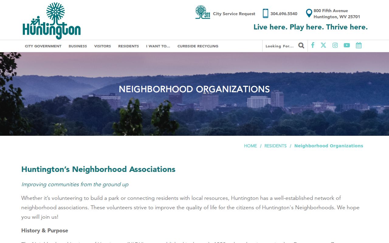
The list gives a civic way to meet Huntington neighbors without turning community membership into a private-person directory.
Huntington Neighbor Voter Records
The West Virginia voter status lookup is designed for a person checking registration with a first name, last name, and date of birth. It updates nightly. It is not a browse-by-block roster. A permitted voter-list request routes through the Secretary of State or Cabell County Clerk and remains subject to state limits.
West Virginia Code §3-2-30 excludes telephone numbers, email addresses, Social Security numbers, and driver's-license numbers from public voter copies. It also bars commercial solicitation, advertising, and resale uses. If a lawful list contains an address, label it as a voter record at the list date. Do not infer who else shares the home or treat registration as a complete address history.
Note: Parcel adjacency and voter registration are separate evidence layers; neither should be used to fill gaps in the other.
Compare Huntington Neighbor Sources
Official records and commercial neighbor tools serve different purposes. Government sources state the office, record type, field labels, and available correction path. Commercial tools may combine old files without showing why a name is tied to an address. Treat those products as leads only, and return to the official custodian before relying on a result.
| Source type | Useful for | Main limit |
|---|---|---|
| GIS and assessment | Parcel location and recorded ownership | Does not prove who occupies the parcel |
| Deed and permit files | Recorded land parties and address activity | Parties may live or work elsewhere |
| Association page | Public contacts and meeting context | No complete membership roster |
| Commercial compilation | Possible search leads | May be stale, merged, or weakly sourced |
For each result, save the URL, access date, and relationship label. That small record trail makes errors easier to spot and gives the named office enough detail to correct its own file.
Protect Huntington Neighbors' Privacy
West Virginia public access has firm limits. FOIA does not open protected personal or medical details, confidential investigative records, some utility customer information, or fields shielded by another law. The Address Confidentiality Program uses substitute addresses for eligible participants. Never try to reverse that substitute address or combine records to uncover a protected location.
Nearby owners, renters, family members, and visitors are not interchangeable. Remove full dates of birth, Social Security numbers, financial data, medical details, and protected victim addresses from notes or images. If a record appears wrong, contact its custodian with the parcel, permit, deed, or case key. A person named on a neighboring parcel should not be treated as a confirmed resident without a record that directly supports that narrower statement.
Lawful use. Use Huntington neighbor records for lawful civic and personal research. Never watch, harass, threaten, or harm another person.
Good neighbor research ends at the limit of the public record. Community meetings and public contacts are safer ways to learn about block concerns than building profiles of private households.